![]()
![]()
![]()
![]()
![]()
![]()
![]()
![]()
![]()
![]()
![]()
|
|
|
|
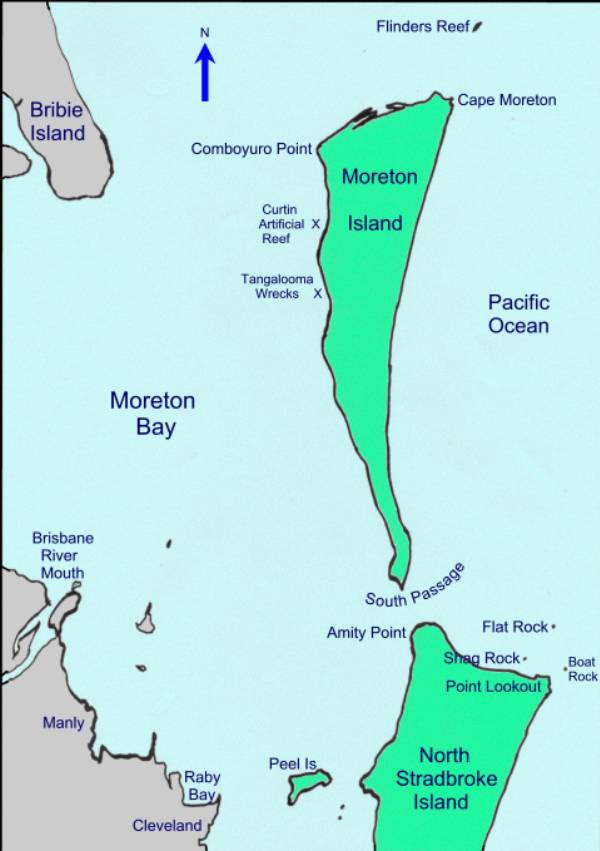
Moreton Bay was supposedly named by Captain Cook, however history books say that he was actually looking at the �bay� formed by the northern shore of Stradbroke Island and the east coast of Moreton Island, and he spelt it differently! From his low observation point on the Endeavour, he had no way of knowing that there was a major river flowing into a large bay behind what he thought was the coastline. Anyway, our Moreton Bay is protected by the surrounding islands which are made of ancient sand, except for some rocky formations which form a line of reefs and the two headlands, Cape Moreton and Point Lookout. Because of the distance
travelled from the mainland, the water visibility is usually very good. At open ocean dive sites, visibility can
reach 20 metres. During winter,
conditions improve even more with the calm seas. Stradbroke IslandDuring winter, our dive sites off Point Lookout, North Stradbroke Island become home to the Grey Nurse Sharks. The most popular dive sites here are Flat Rock, Boat Rock, Manta Ray Bommie and Shag Rock. Click here to see a large scale chart of the area. Moreton IslandMost of Moreton Island is a national park with a few small settlements. The main dive sites are off Cape Moreton on the north eastern corner of the island. The most popular dive sites here are Flinders Reef and Smith Rock. Click here to see a large scale chart of the area. When conditions are rough in the open ocean, we dive on the inside of Moreton Island at sites called Comboyuro Drop Off, The Pines, Curtin Artificial Reef and Tangalooma Wrecks.
|
|
|